


Real Projects. Real Impact.
Discover how W.G.S SARL operates across diverse marine and terrestrial environments. From drone flights to underwater surveys, watch how we offer you to deliver precision in every project.


Our Values
Driving Excellence, Empowering Sustainable Progress
At W.G.S SARL, our core values drive every project we undertake. We prioritize excellence, partnership, and sustainable practices to deliver superior results.
Experience
Decades of proven field expertise ensure reliable and accurate project outcomes.
Challenge-Driven
We thrive on tackling the toughest marine and land conditions with innovative solutions.

Our Services
Tailored Solutions for Your Projects
Our services encompass a wide range of maritime, coastal, and terrestrial projects. We leverage advanced technology and expert knowledge to deliver precise results.

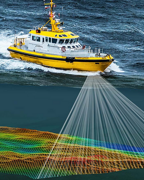
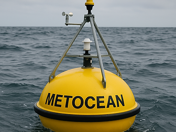
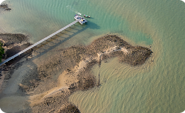
Hydrographic & Oceanographic Surveys
We conduct precise surveys in coastal, river, and lake environments using advanced and single-beam echo sounding technologies.
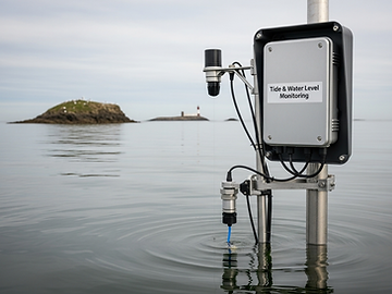
Tide & Water Level Monitoring
We install and manage tide gauges to deliver real-time water level data, helping optimize dredging operations.

Geophysical & Geotechnical Studies
From magnetometer scans to side-scan sonar and sub-bottom profiling, we analyze subsurface conditions .
Environmental Studies & Surveys
Our experts conduct sediment and water sampling, pollution assessments, and real-time dredging monitoring.
Topographic & Photogrammetric Surveys
Using drone-based photogrammetry and 3D modeling, we provide accurate land and underwater terrain analysis.
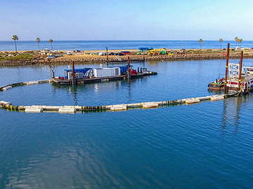
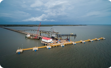
Dredging & Structural Support
We monitor dredging volumes and inspect underwater structures, ensuring compliance and operational safety.
Industries Served
Diverse Sectors We Cater To
At W.G.S SARL, we provide specialized services across various industries. Our expertise in hydrographic, topographic, and environmental studies ensures that we meet the unique demands of each sector. From mining to marine engineering, we deliver precise data for informed decision-making.
Mining & Mineral Extraction
Precise surveys for resource mapping and site planning. Supports safe, efficient mining operations.
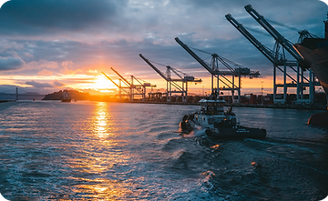
Port Construction & Expansion
High-accuracy data for marine design and dredging. Enables secure and scalable port development.
Coastal Protection & Dredging
Real-time data for erosion control and dredging. Ensures coastal stability and project success.

Our Quality
Why Choose W.G.S SARL for Your Projects
At W.G.S SARL, we combine local expertise with global best practices to deliver exceptional results. Our commitment to quality ensures that every project is executed with precision and care.
Equipped for onshore, nearshore, and offshore conditions.
Tailored solutions for unique project environments.
Reliable data collection and reporting you can trust.

Surface-to-Seafloor Precision
High-resolution imagery and sonar data working together for complete terrain and bathymetric coverage.


FAQ'S
Find quick answers to common questions about our services, processes, and how we support your project from start to finish.

5 min read
Hydrographic & Oceanographic Surveys
We conduct precise surveys in coastal, river, and lake environments using advanced and single-beam echo sounding technologies.

5 min read
Hydrographic & Oceanographic Surveys
We conduct precise surveys in coastal, river, and lake environments using advanced and single-beam echo sounding technologies.

5 min read
Hydrographic & Oceanographic Surveys
We conduct precise surveys in coastal, river, and lake environments using advanced and single-beam echo sounding technologies.
Hydrographic Surveys * Drone Mapping * Environmental Studies * Topographic Analysis * Dredging Monitoring * Real-Time Data
Contact Us
Get in Touch
We're here to help with your project needs. Reach out to us for expert support in hydrographic, topographic, and environmental survey solutions.